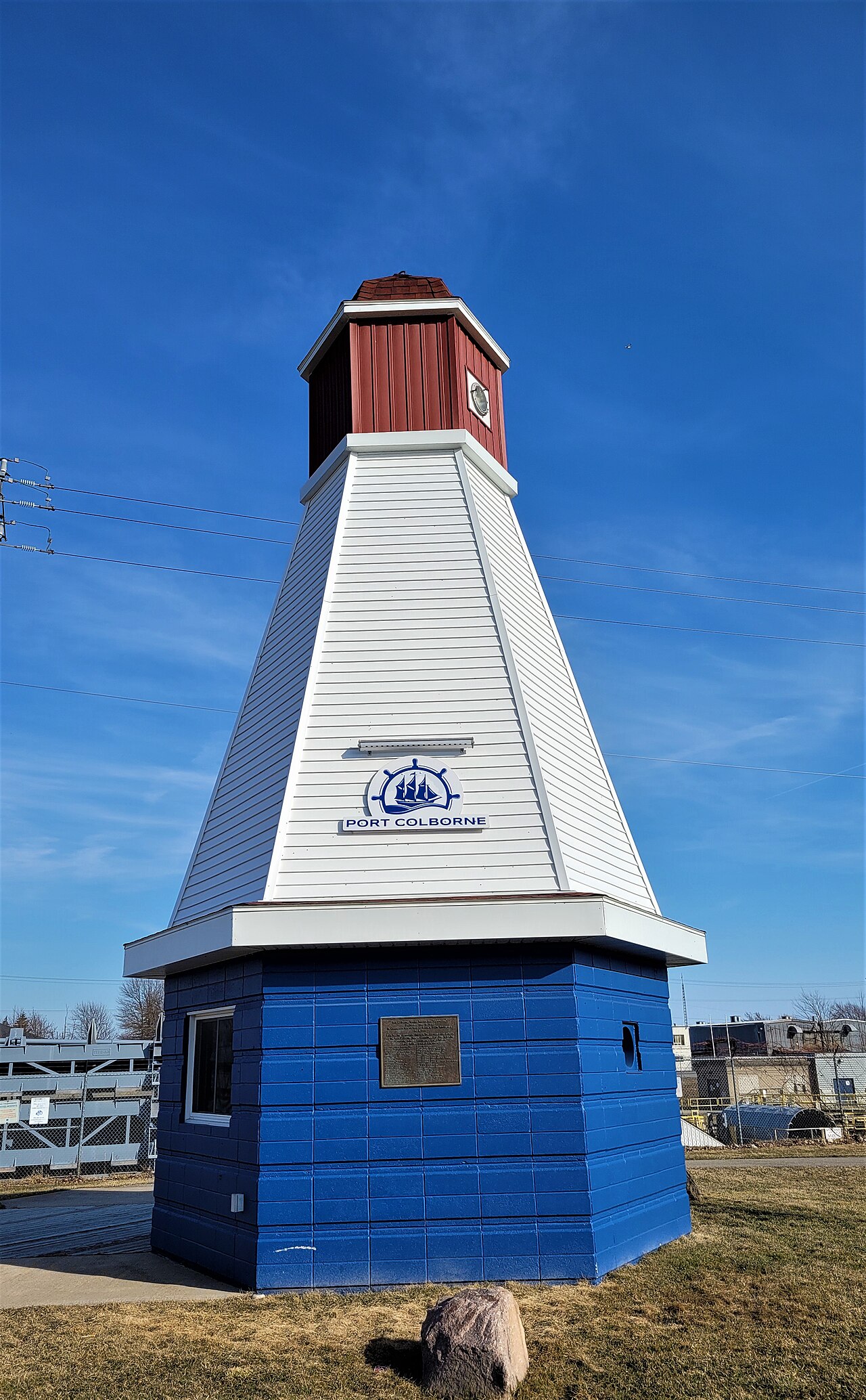
Historic Port Colborne: The Welland Canal Town
How a Lake Erie harbour became the southern gateway of the Welland Ship Canal — told through the grain elevators, freighters, and industries preserved in the Niagara Falls Public Library’s Historic Niagara archive.
In This Guide
The Lake Erie Gateway
Port Colborne occupies the Lake Erie end of the Welland Canal — the southern terminus where ocean-going lakers leave the lake and begin the climb toward Lake Ontario. That single fact shaped everything about the town: its harbour, its industries, and its skyline of grain elevators all exist because this is where ships line up to enter the canal.
The harbour’s working life is unusually well documented. The Niagara Falls Public Library’s "Historic Niagara" digital archive holds photographs and postcards of Port Colborne stretching from sailing ships in the harbour around 1884 through to the freighters and tall ships of the late twentieth century — a continuous visual record of a single Great Lakes port.
Building the Ship Canal Harbour
The Port Colborne harbour you see today was not natural — it was dug. Archive photographs dated around 1922 show the Welland Ship Canal harbour under excavation, including work near where the canal crosses Main Street. This was part of the major early-1920s reconstruction that turned the older, shallower canal into the deep ship canal capable of handling modern lake freighters.
At the lake end sits Lock 8, the final lock in the system. A commemorative monument at Port Colborne honours John Hansen, builder of Lock 8, and a separate plaque at the lock marks the 150th anniversary of the Welland Ship Canal — both small but telling markers of how central the canal is to the town’s identity.
Grain, Nickel, and Industry
Where there is a ship canal, there are mills. Port Colborne’s waterfront filled with grain elevators and flour mills — Maple Leaf Mills (the Maple Leaf Flour Mill), the Government Elevator, Niagara Grain & Feed Co, and Robin Hood Flour Mills all appear repeatedly in the archive’s postcards. One colour postcard of a single grain elevator, published around 1920 by F. K. Brown, a Port Colborne druggist and optician, shows a brick building more than four storeys high with railway boxcars drawn up beneath a steel loading structure.
Heavy industry followed the grain trade. The plant of the International Nickel Company (INCO), the Canada Furnace Co, the Canada Portland Cement Co, and a starch factory all operated here, drawing workers to a genuinely industrial Lake Erie town rather than a tourist one. That working-class heritage is the backdrop to everything visitors see along the canal today.
A Century of Ships
The archive’s strength is its ships. Images run from sailing vessels such as the "Ethel" tied up at the docks, through working freighters like the "Mantadoc" frozen into a snow-covered harbour in 1982, to the locally built "Trillium" photographed under construction and afloat in 1975.
Tall ships became part of the harbour’s story too — visiting replicas of historic vessels and training ships gather along the west wall, a tradition that continues at the town’s marine heritage festival each summer. Together the photographs show a harbour that never stopped working, only changed what it carried.
Beyond the Canal: Town Life
Port Colborne was more than its waterfront. The archive records the Humberstone Club, the Long Beach Ballroom, the 2nd Canadian Garrison Regiment’s Port Colborne post, and the landmark Sugar Loaf — the prominent point and hill above Lake Erie that gives the modern Sugarloaf Marina district its name.
It also captures the town’s connection to the wider region ending: a 1959 photograph shows the last streetcar run from St Catharines to Port Colborne, the trolley clearing ice from the tracks on its final journey — the close of one era of regional transport even as the canal kept the harbour busy.
About the Historic Niagara Archive
The images referenced here are held by the Niagara Falls Public Library in its "Historic Niagara" digital collection, an online archive of postcards and photographs covering the Niagara region, including the Francis J. Petrie postcard collection. It is a free, searchable public resource and the single best visual record of Port Colborne’s canal-era history.
Rights vary item by item — some images are public domain while others remain under copyright — so we describe the collection in words and credit the library rather than reproducing restricted images. To view the originals, search the Niagara Falls Public Library’s Historic Niagara archive, where many photographs may also be viewed in person at the Victoria Avenue location.
Photos
Frequently Asked Questions
Why is Port Colborne historically important?
It sits at the Lake Erie end of the Welland Canal, the southern gateway where lake freighters enter the canal. That position made it a major grain-shipping and industrial harbour, with grain elevators, flour mills, a nickel refinery, and a furnace and cement works built up around the waterway.
What is Lock 8 in Port Colborne?
Lock 8 is the final lock of the Welland Ship Canal at the Lake Erie end. A monument in Port Colborne honours John Hansen, the builder of Lock 8, and a plaque at the lock commemorates the 150th anniversary of the Welland Ship Canal.
Where can I see historic photos of Port Colborne?
The Niagara Falls Public Library’s "Historic Niagara" digital archive holds postcards and photographs of Port Colborne’s harbour, ships, mills, and industries from the 1880s through the late 1900s. It is free to search online, and many originals can be viewed in person at the library’s Victoria Avenue location.
When was the Port Colborne harbour built?
The deep ship-canal harbour was excavated in the early 1920s; archive photographs dated around 1922 show the Welland Ship Canal harbour under construction as the older canal was rebuilt for modern freighters.